


In demand worldwide: GEOS3D from Tyrol measures pipeline in Morocco with unimagined precision.
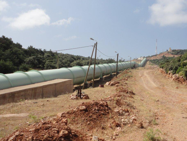
The pipeline between reservoir and the pumped-storage power plant near a city in Morocco is the lifeline of the region. After problems with the weld seams of the pipeline, the engineering office GEOS3D from Telfs/Tyrol was commissioned for high-precision measurements by laser scanner.
»Our mission: Precision« is the performance promise of the Surveying Office GEOS3D. The motto is no coincidence that GEOS3D has exclusive technology and the necessary experience to handle such demanding measuring tasks as those in Morocco.
0.2 millimeter measuring accuracy
The customer's problem: after 20 years of operation, the area around the welds of the 1.5 km pipeline began to move. Therefore, the operator commissioned an engineering company from France with a detailed analysis of the damage and a proposed solution. An important prerequisite for this was the high-precision measurement of the geometry around the longitudinal seams with a measurement accuracy of 0.2 millimeters. With this challenge, they turned to the Institute of Engineering Geodesy and Measuring Systems at the Graz University of Technology. In this project, it performed the data evaluation and carried out the task of collecting data for GEOS3D, a well-known center of expertise for difficult surveying tasks around the world.
Only two possibilitiesAfter thorough testing, ultimately only two systems were considered - a laser tracker and a laser scanning system. The laser tracker measures single points in 3D with sub-millimeter accuracy. Accuracies in the tenth and hundredths of a millimeter range are possible - at measurement distances of 20 meters and more. However, this system is time consuming: Each pipe segment should be scanned about 0.5 meters above and 0.4 meters below the respective weld with 30 to 50 points. The measuring time for the complete pipeline thus took about four weeks.
Laser scanner: fast & accurate
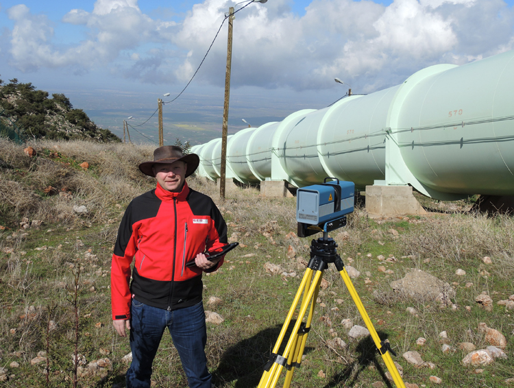
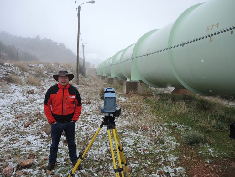
As a second possibility, a laser scanning system was considered. But only one terrestrial laser scanner can automatically scan areas with sub-millimeter accuracy at a very high speed: the Surphaser Laser Scanner from GEOS3D. Accuracies of 0.1 to 0.2 millimeters are possible, thus perfect for this measurement task. With a scan of about three minutes, GEOS3D could measure three segments. The measurement time for the entire pipeline was thus reduced to seven days – in some of the most adverse weather conditions in February 2015 with snow and in August with heat. At the same time, the scans provided significantly more data in the sought-after areas (approximately 3.5 million measurement points) than would have been possible with single-point measurement methods. The GEOS3D engineering office, which is one of the few measurement bureaus to have this system, offers its services worldwide.