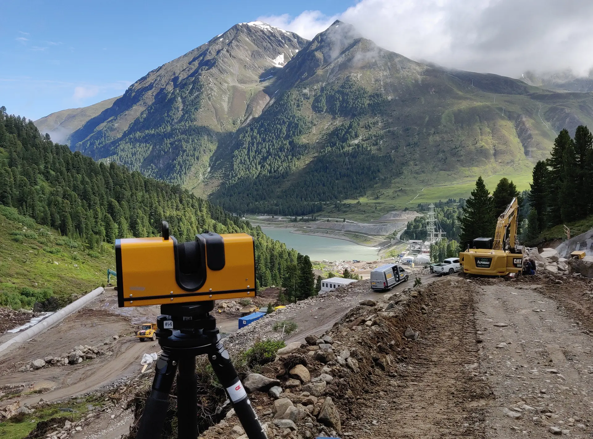
SURPHASER 3D LASER SCANNER
SALE AND SERVICE

As pioneers in the use of this technology, we offer all measuring services utilizing the laser scanner. Years of experience and state-of-the-art technology guarantee optimum results.
Our customers can also buy Surphaser models from us – naturally including consulting, demo and training.

  • For components starting from approx. 0.5 x 0.5 x 0.5 m3
  • Efficient digital representation of large components
  • Wireless (battery and WiFi control)
  • Portable
thumb description
With Surphaser, the geometry of components is measured in three dimensions. The Surphaser's unsurpassed accuracy makes it ideal for industrial applications such as quality control and reverse engineering.

The Surphaser scans 360° of its surroundings or adjustable subsections. A few scans are sufficient, for example, for the all-round digital representation of a vehicle body. The scans are automatically referenced in a mutual coordinate system.

  • CHARACTERISTICS
  • TECHNICAL SPECIFICATIONS
  • APPLICATIONS
  • SOFTWARE
  • Unsurpassed measurement accuracy, data quality and scanning speed
  • Very low measurement noise – sub-millimeters for all models
  • Up to 1.2 million data points per second
  • Measuring ranges from 0.2 to 250 m
  • Digital representation of almost all surfaces without preparation
  • Can measure deep cavities and capture extreme geometries
  • Surface brightness and color information (optional) is captured for each data point
  • Robust dust and splash-proof housing for use in industrial environments or outdoors
  • Light and portable – Fits in cabin baggage (aircraft)
  • Fully automatic referencing of multiple scans

Advantages of the Surphaser

compared to triangulation systems (strip projection, hand scanner, photogrammetry)
 
  • Large working area
  • No shading due to triangulation
  • No surface preparation required
  • Large components are captured faster
  • Measurement of complex geometries and deep cavities

Advantages of the Surphaser

compared to other terrestrial laser scanners
 
 
  • Higher precision & lower measuring noise
  • Selection & digital representation of subsections
  • High speed
  • Very low measurement noise --> no additional work required for data cleansing
ModelIllustrationRecommended working range in mmMeasurement noise in mmAccuracy in mmLaser classColor camera
75USR Abbildung 0,25 ... 2,5 0,025 < 0,15 at 1,5m 3R (685nm) Integrated
100HSX-SR Abbildung 1 ... 7 0,024 at 4m < 0,3 at 3m 3R (685nm) Option
100HSX-IR HS* HQ Abbildung 1 ... 35
1 ... 50
0,07 at 10m
0,16 at 10m
< 0,35 at 5m
< 0,7 at 15m
3R (685nm) Option
10 HS* HQ Abbildung 1 ... 50
1 ... 110
0,12 at 15m
0,25 at 15m
< 0,7 at 15m
< 0,9 at 15m
1 (1550nm) Integrated
400 HS* HQ HP Abbildung 1 ... 250
1 ... 140
1 ... 110
0,1 at 15m
0,07 at 15m
0,2 at 15m
< 0,9 at 15m
< 0,7 at 15m
< 0,9 at 15m
1 (1550nm) Integrated
25HSX-IR Abbildung 0,5 - 30 0,1 at 3m < 0,5 at 5m 3R (685nm) Option
SurphSLAM Abbildung Mobile laser scanning based on the Surphaser Model 10 and the GeoSLAM solution.
Automatic real-time referencing of scan data without GPS.
Watch video now
The models 10, 75, 100 and 400 are equipped with an integrated battery, processor and SD card slot and can be used independently of a computer and power supply. Control through WiFi (tablet, laptop) or through USB.<br>
*The operating modes HS (higher accuracy) and HQ (longer range) can be selected by the user via software.

APPLICATION AREAS

  • Quality assurance
  • Reverse engineering
  • Deformation measurements
  • Archaeologists
  • Historical projects
  • Architects
  • Forensics

EXAMPLES:

  • Boats
  • Buses
  • Heritage protection
  • Film & animation
  • Airplanes
  • Buildings – interior
  • Tidal power plants
  • Historical artifacts
  • High-voltage pylons
  • Helicopters

  • Industrial plants
  • Minibuses
  • Cars and trucks
  • Internal ship components
  • Trams
  • Tunneling
  • Submarines
  • Wind turbines
  • Yachts
  • Trains
SoftwareFunctionality
SurphExpress Standard Scanner control
Import and export of scan data
3D visualization of scan data
Marker extraction
Data preparation
SurphClient Remote control of the Surphaser via WiFi
Visualization of brightness images
ProcessC3D Batch processing of scan data
Marker extraction
Autoreferencing of multiple scans
Automatic mapping of externally recorded color data
Data preparation
Polyworkspolyworks Integration of the Surphaser as a measuring system
Scanner control
Automatic referencing

PolyWorks® is the complete solution for processing and evaluating three-dimensional data. As a universal software platform in coordinate metrology, PolyWorks supports a variety of optical and tactile digitizing systems. In addition to single point measurements, PolyWorks can also be used to digitally represent, analyze, process and compare entire surfaces. Whether in design, quality assurance or landscape surveying: the potential applications are almost unlimited. Powerful software modules are available for quality control and reverse engineering. PolyWorks has been being developed by the Canadian company Innov - Metric Software Inc. for over 15 years.

Duwe-3d AG is the European partner and exclusive representative of InnovMetric Software Inc. in Germany, Austria and Switzerland for all questions regarding the PolyWorks® software, including sales, training and support.

RealWorks Survey, Leica Cyclone, Geomagic, etc. The Surphaser scan data is exported to PTX or other compatible file formats.
Inquiry Form
*Required fields
We use cookies to enhance your experience. More information can be found here.